Mar 122012
 

Versiune în română

Destination USA, Episode 1

I’ve decided to take a short break from the Australian story but not to worry I’ll be back soon with more about the trip down under. The break is due to the fact that I wanted to write the first post of what I hope to become a series on American destinations. This idea was prompted by a posting on a Romanian blog, where the author asked the readers to name the popular destinations that don’t attract them. Among the places listed many of the readers mentioned United States as being unattactive for them. Having lived in USA for quite a few years and traveled around many parts of it, I think many people have the wrong impression about what’s to see in United States. Most have the idea, undoubtely promoted by the many movies and TV series, that America is made of NY and LA and maybe the Grand Canyon. While NY and LA are one facet of USA, there’s much more to see around the country, beautiful places that are truly unique.

For this first post of the series I picked a place that I really enjoyed, so much so that I went back three times to visit it again: Death Valley National Park.

Located in east-central California, on the border with Nevada, Death Valley is one of the most interesting places to visit in the southwest USA. This national park holds a number of records like being the lowest place in North America (282 feet below sea level), the driest and hottest place in the Western Hemisphere (highest temperature on record of 57.8 °C on June 10, 1913 is close to the world record of 57.8 °C registered in ‘Aziziya, Libya, on September 13, 1922).

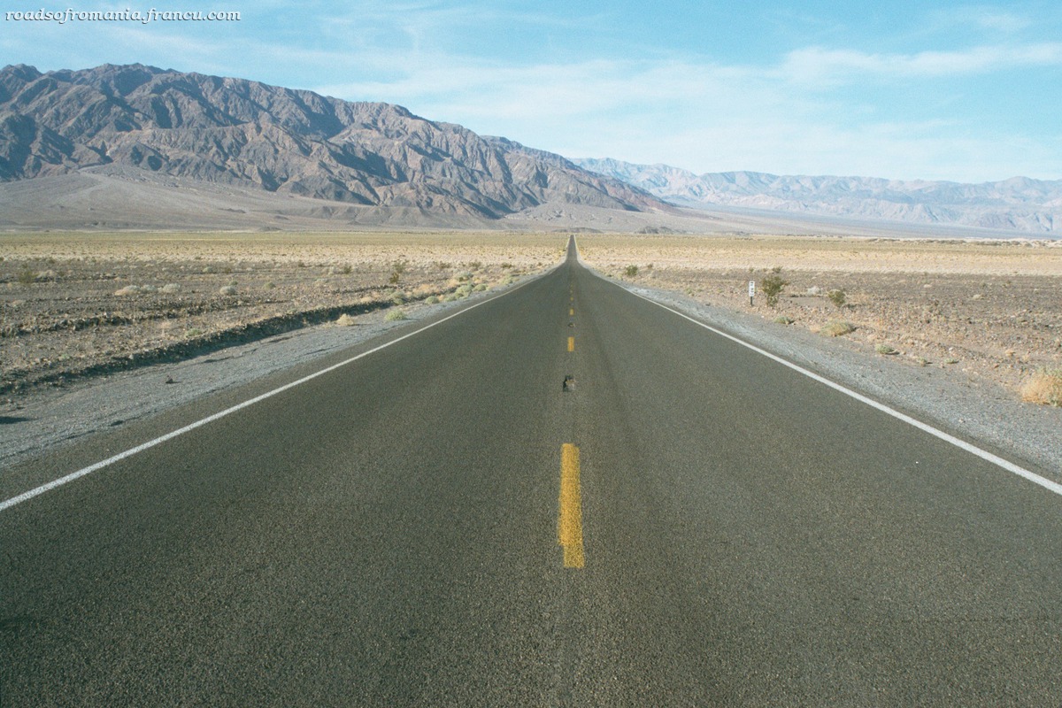
After visiting for the first time in October 2001 I returned to the Death Valley three times. That first trip took me from San Francisco to Death Valley, Las Vegas, Grand Canyon and back. It was the first time that I discovered the beauty of the American southwest. The years that followed I explored it every time I had the chance. My last trip to the valley was in November 2009, when we drove to the park from Las Vegas. No matter what direction you’re coming from, when you enter the valley you’ll be struck by the spectacular terrain which changes from High Sierras to desert, a valley like a vast emptiness all around you, the mountains high, far away in the background. It feels like you’re leaving the rest of the world behind you, and all you can see except for the empty landscape is the straight road up ahead, disappearing into the horizon. You might as well be on an alien planet, in some undiscovered solar system. And still … Despite the apparent starkness there’s plenty to see. You have canyons, craters, bright colors, sand dunes, good looking ruins, grand views, even rocks that move. For those seeking solitude this is the perfect place. Even if some attraction points might seem a bit crowded, if you leave those behind within a few minutes you’ll find yourself completely alone, nobody driving either way, wind blowing in your ears, thousands of acres of land without a human soul in sight.

Even though at first the valley might appear featureless that impression is false as there’s plenty to see. My must see sites in Death Valley include:
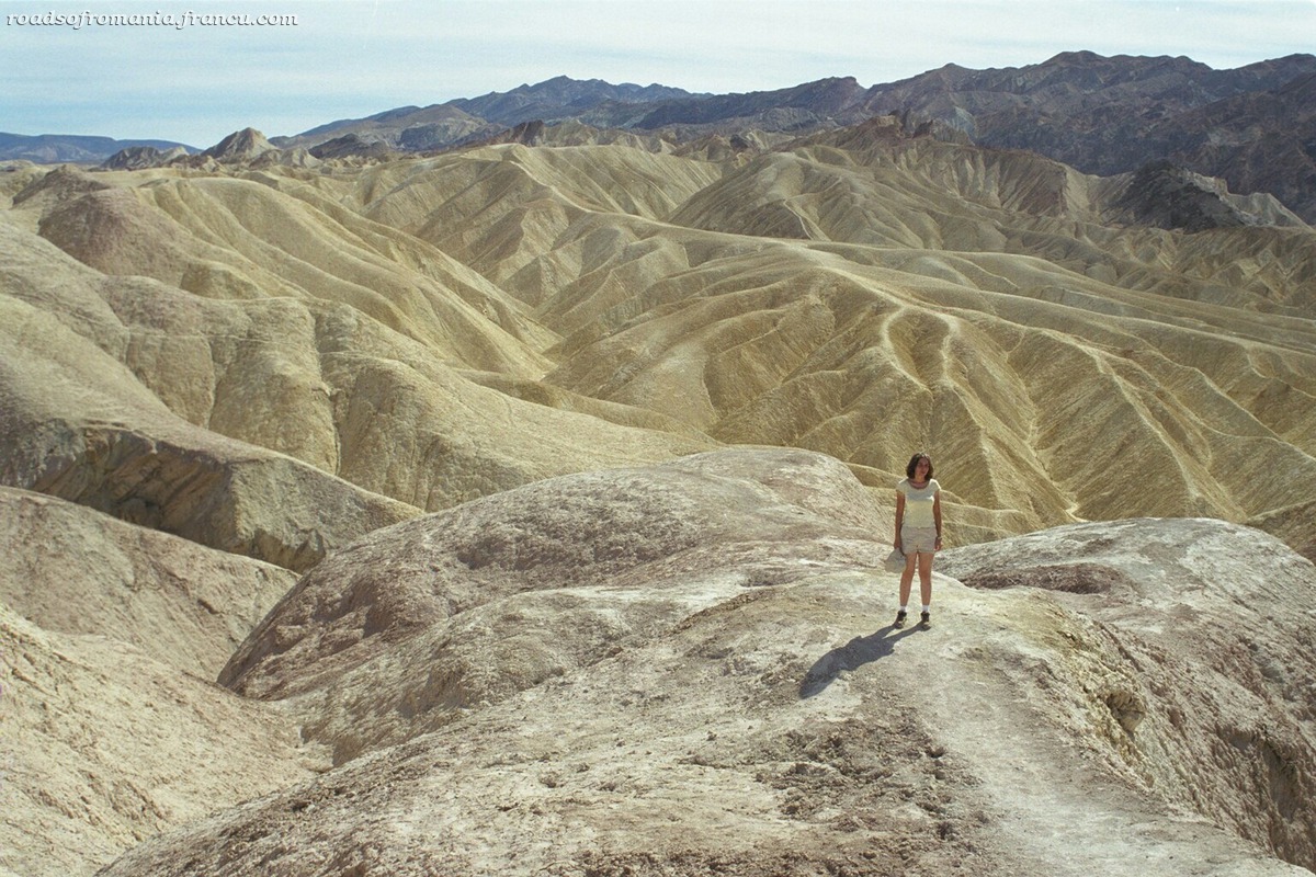
Zabriskie Point

Made famous by Antonioni’s film with the same name (1970) Zabriskie Point offers some beautiful views of the Golden Canyon badlands. The yellow and beige colored hills were once lake bottom sediments. The point is named after Christian Zabriskie, an important figure in Death Valley borax mining.

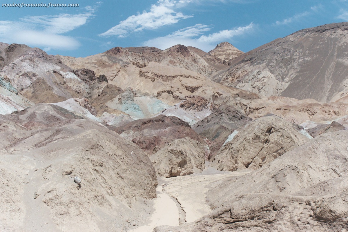
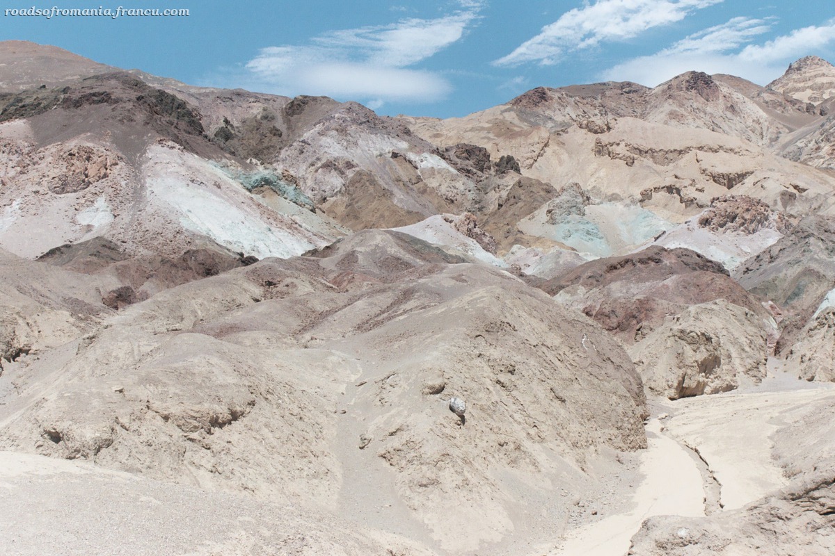
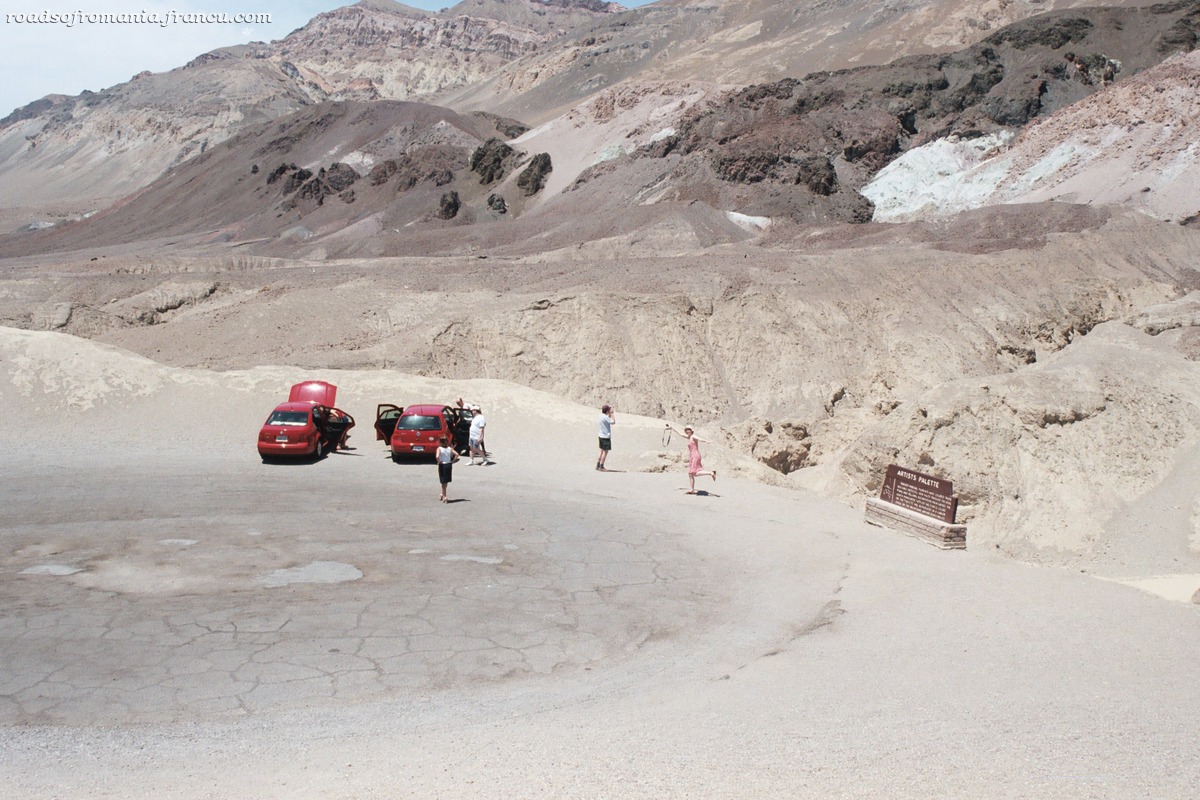
Artist’s Drive and Artist’s Palette

This is a one-way nine miles scenic drive through hills splashed with colors from mineral deposits. There are reds, yellows and pinks from the iron salts, green from decomposing mica, and purples from manganese. About halfway through the drive is Artist’s Palette a remarkable spot which is worth a stop.

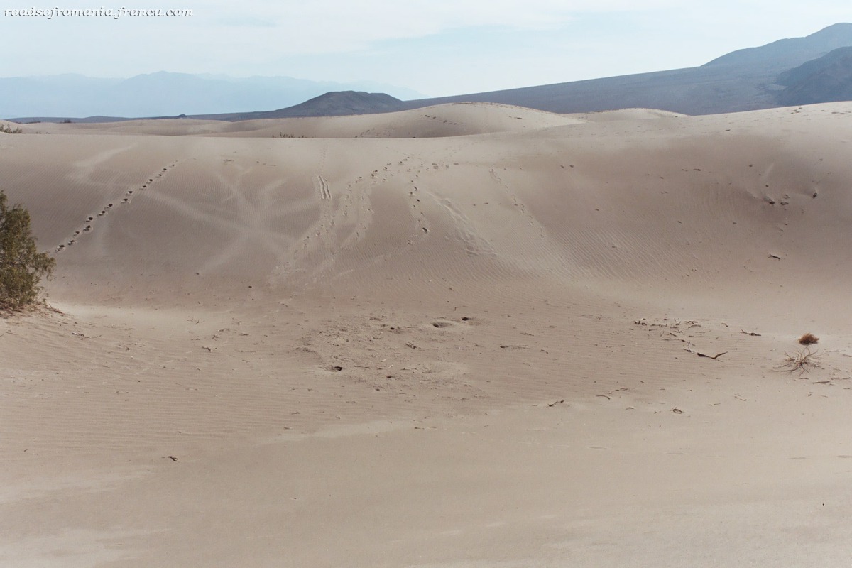
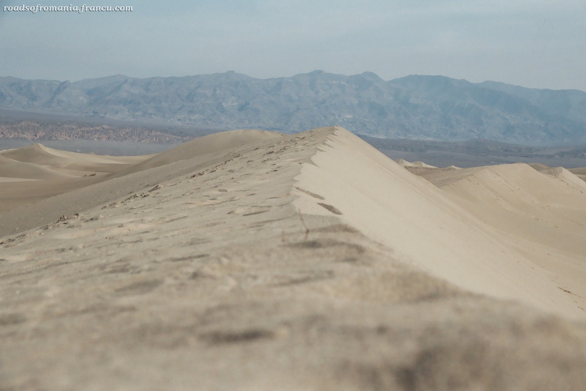
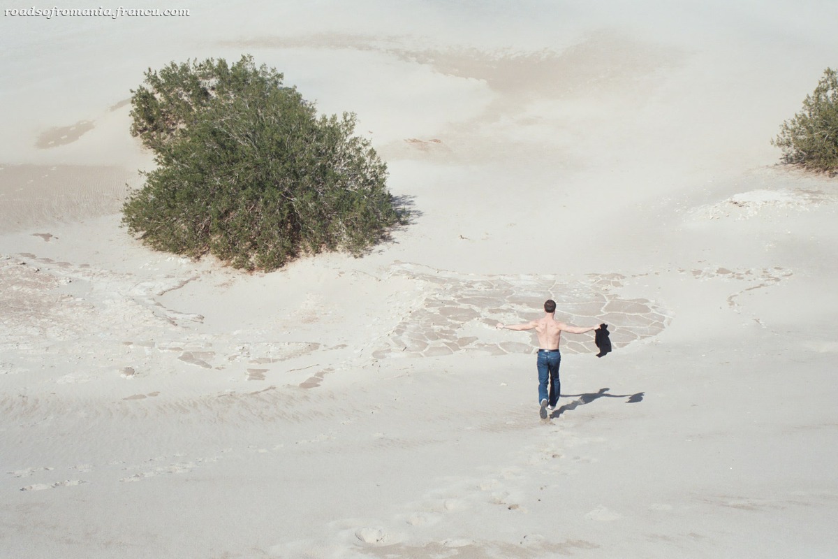
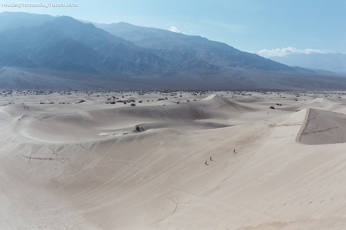
Stovepipe Wells Sand Dunes

Located very close to Stovepipe Wells are the undulating sand dunes. They are being continually recreated by the winds which carry sand from the mountains and then deposit it here. The dunes can be explored by foot (park on the side of the road). There is no trail, but that is part of the fun, you can create your own trail.
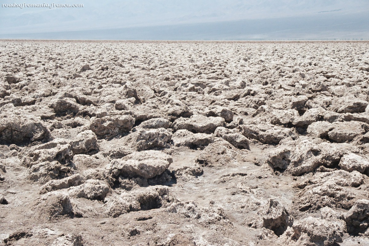
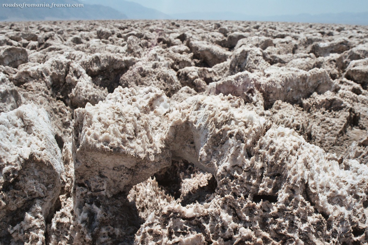
Devil’s Golf Course

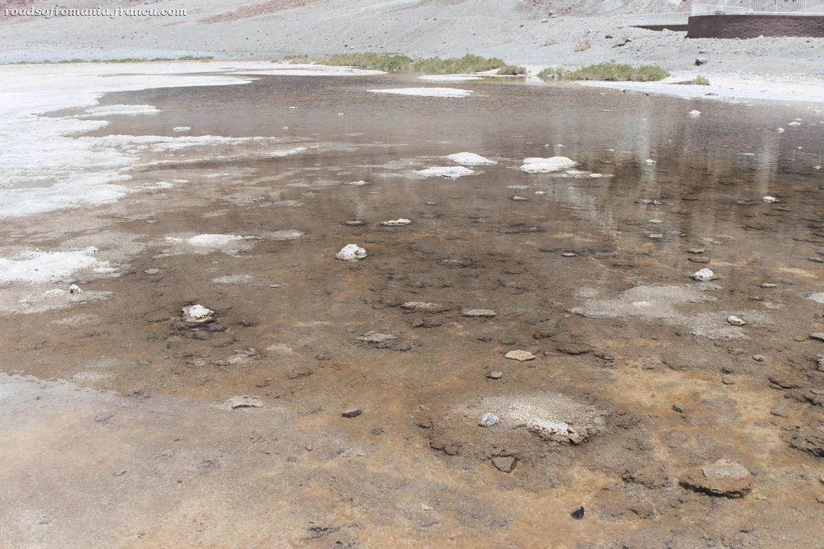
A field of salt pinnacles today, this used to be a lake more than 2000 years ago. When the lake evaporated, it left behind the layers of crystallized salt. This is constantly recreated as salty water is brought to the surface through capillary actions and then it evaporates resulting in new salt crystals. You can hear the noises made by the salt as it expands and contracts with the changes in temperature.
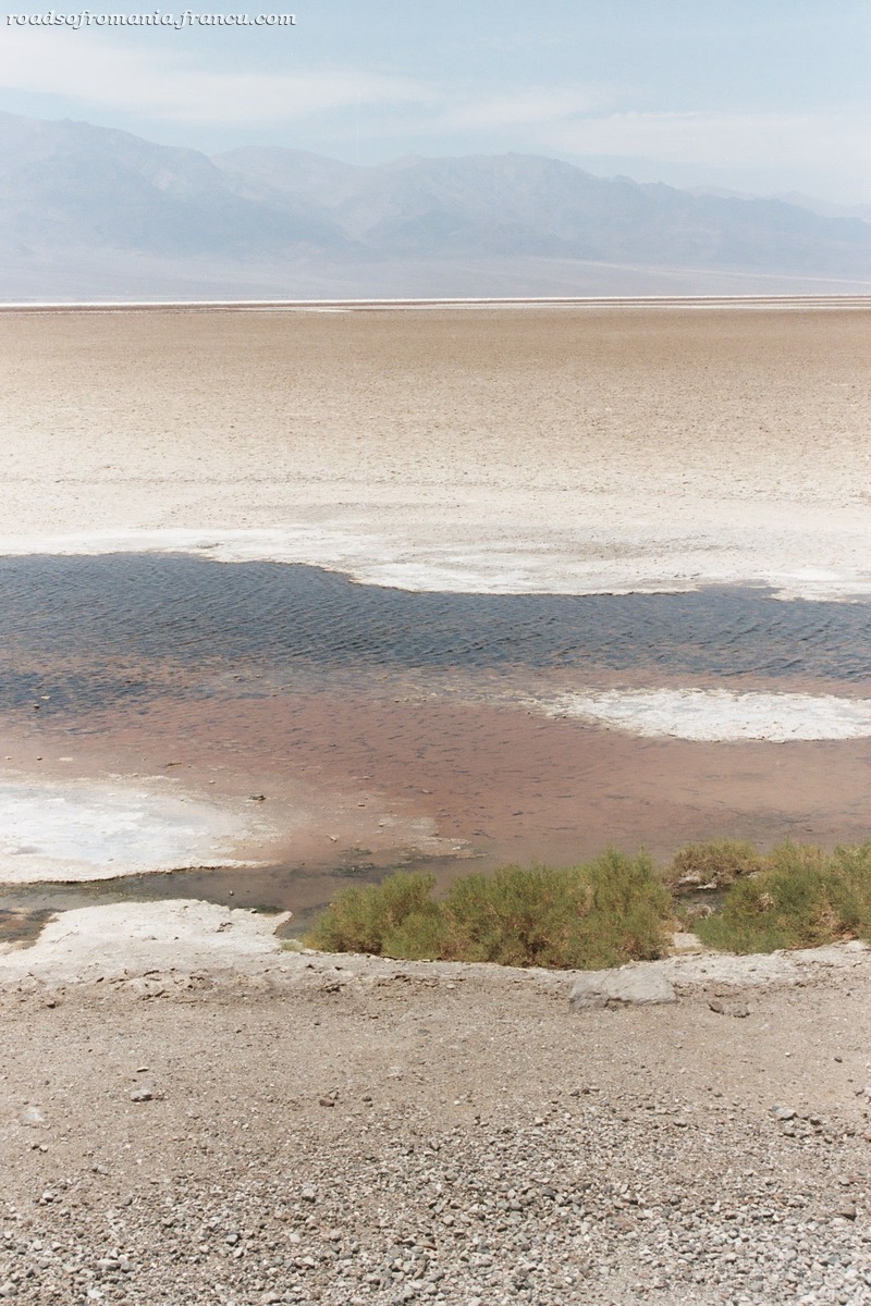
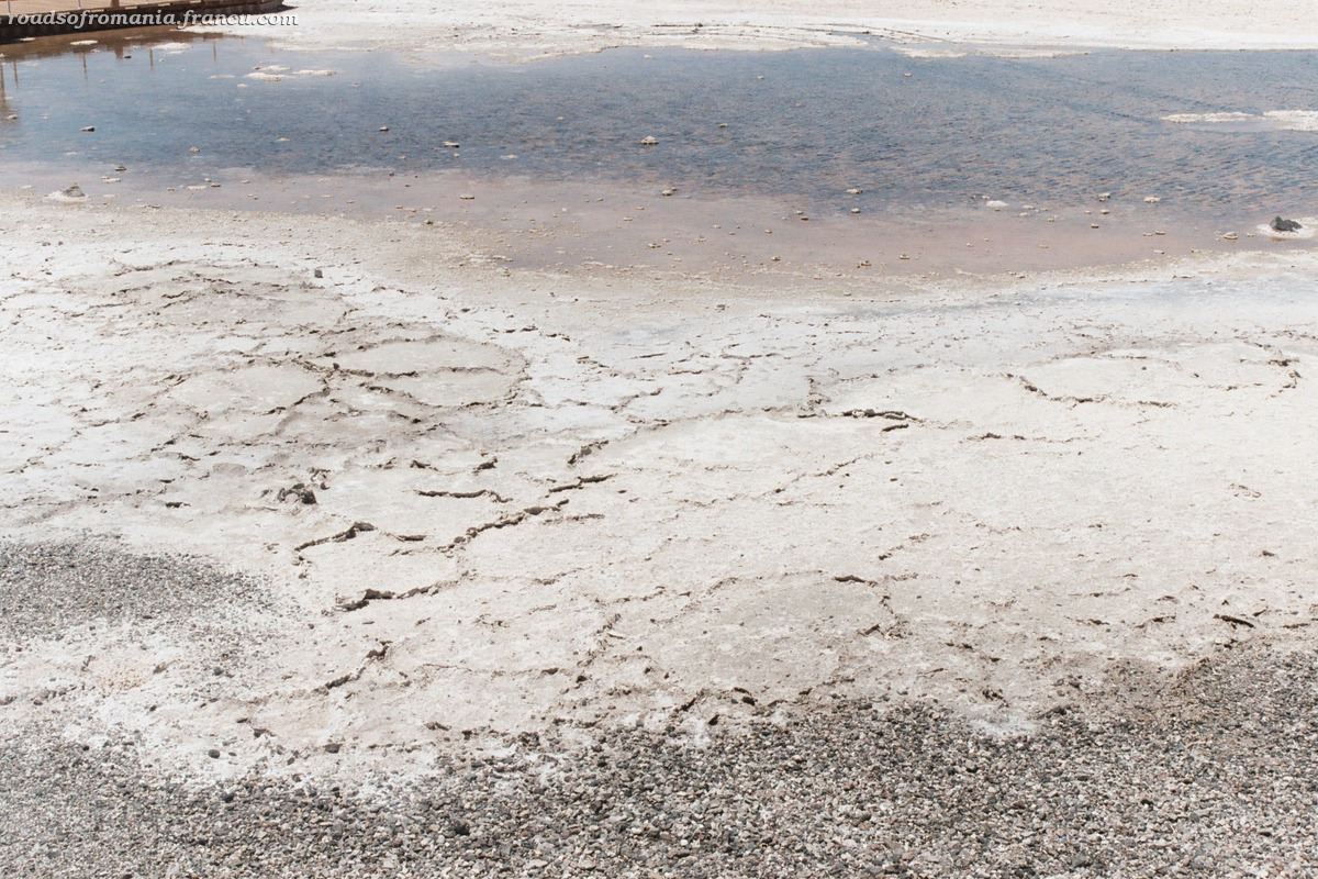
Badwater

Badwater is the lowest point in the western hemisphere, 282 ft (85m) below sea level and also the hottest spot in the park. There’s a small pool of water which surprisingly hosts life (if we were to believe the signs that mark the spot). Turn around and look up the rocky wall to find the sign that marks the sea level.
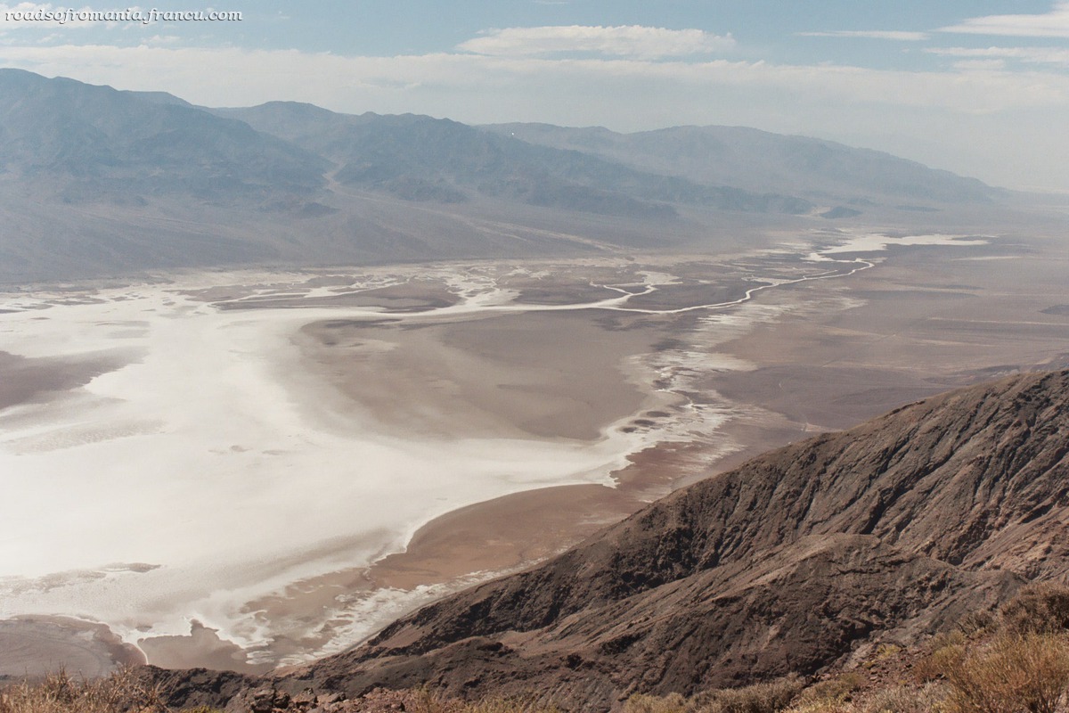
Dante’s View

Dante’s View is situated at 5475 ft (1650m) on a peak of the Armagosa Range. It offers a spectacular view of the Valley below surrounded by ranges of mountains. This is where you experience the “big picture” of Death Valley. Pools of Badwater lie below; across the valley is the Panamint Range, with its highest point Telescope Peak.
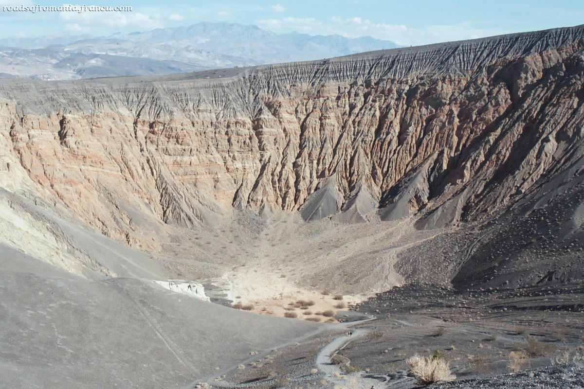
Ubehebe Crater

The Ubehebe Crater is located in the north of the Valley and it’s quite a drive to get there. But if you plan to see Scotty’s Castle then Ubehebe is only 8 miles away from the castle. The crater was formed by a massive volcanic steam explosion a few thousand years ago. There is a trail to the bottom of the cone.

And the list doesn’t stop here. If you have the time to explore more of the park you can also visit Scotty’s Castle, Twenty Mule Team Canyon, the Natural Bridge, Harmony Borax Mines, Devil’s Cornfield, Titus Canyon etc. There’s even a spot where one can look at the tracks of some mysterious sliding rocks at, a place called the Racetrack which I have yet to visit (the road is in really bad shape and we’ve been warned that many cars have lost all 4 tires trying to access it so we didn’t dare to try it in our rental car). The biggest hurdle for all these visits is time, since the park is huge and it takes time getting from one point to another. I recommend that you give the park two days, spending the night here, this way
you’ll have more time to see all the park has to offer.

I hope I convinced you to visit and that if you ever find yourself in the American southwest you’ll take a detour and see Death Valley. In my next post I’ll talk a bit about the planning needed to visit Death Valley.

Sep 282006
 

Versiune în română

Next day we went to Grand Teton, a national park located south of Yellowstone. We drove for almost 100 miles. It wasn’t the best day to visit Grand Teton, since it was hazy and one can barely distinguish the silhouettes of the beautiful mountains that are the attraction of the park. Probably the Teton range looked better in the early morning, but our friends got up late and with all the driving we got to the park at around 1 PM. We drove to Jenny Lake in the south of the park, took a boat to the western shore of the lake and hiked a small trail to the Hidden Falls and to a panorama point called Inspiration Point from where we could see the entire Jenny Lake at our feet. All around this area there were signs advising people that bears are in the area: do not try to feed them – who would be crazy enough to try that? – don’t leave your backpack lying around etc. The hike was pretty, even though a bit crowded with people. On our way back through Yellowstone we passed a sign marking “Continental Divide” which I had no idea what it was but later found out – thanks to wikipedia – that it is “a line of elevated terrain which forms a border between two watersheds such that water falling on one side of the line eventually travels to one ocean or body of water, and water on the other side travels to another, generally on the opposite side of the continent”. In this case the Continental Divide separates the watersheds of the Pacific Ocean from those of the Atlantic or Arctic Oceans.

For dinner we decided not to eat in the park like we did the previous days but go to West Yellowstone. At Alin’s insistence we choose a pizza place. I’m not a big fan of pizza so I ordered macaroni and cheese, comfort food for the soul 🙂 In the menu the m&c; of Wild West Pizzeria of West Yellowstone was advertised as “world renowned”. I don’t know if it is really world renowned but it was very good and it reminded me of a dish that we eat in Romania. I have to say that this was the first time that I ate macaroni and cheese which must be a record of some kind since I’ve been living in US for 10 years and m&c; is pretty popular here. They used to serve it in Intel’s cafeteria from time to time but I never had the curiosity of trying it.

Sep 252006
 

Versiune în română

On our second day in the park we went to see the Grand Canyon of Yellowstone. The impressive sheer drop and the canyon’s yellowed walls made for amazing views. We spent the entire day circling the canyon, stopping at different points of belvedere along the north and the south rims, admiring the two waterfalls – the Lower and the Upper Fall formed by the Yellowstone River – and doing short but steep hikes along the two rims. All in all it was a lovely day.

Sep 232006
 

Versiune în română

Our accommodation in West Yellowstone was a rental house way to big for us, but since we were paying by the person it still came cheaper than a hotel. It had four bedrooms, two on the second floor and two in the basement and a living room and a kitchen on the first floor. It came equipped with a cable TV and grill which came in handy in the evenings. The best part about the house was that is was located very close to the park’s entrance so we didn’t have to drive additional miles – the park is big enough as it is.

On our first day in Yellowstone we went to see the geysers and we started with the most famous one. Old Faithful is where everybody goes and we were lucky to get there 10 minutes before it was scheduled to erupt. Old Faithful erupts every 80 minutes and it’s probably the most predictable geyser in the park. Based on the duration of the last eruption, rangers are able to figure out a time frame for the next eruption. There were crowds of people sitting on benches around the geyser perimeter and waiting patiently in a complete silence like some religious ceremony was about to take place and our voices would ruin the experience. It started with some steam and a little spray and then it erupted into a tall stream of water and steam. The show finished and everybody started in the direction of their car but we decided to stick around and see the rest of the geysers in the upper geyser basin.

We followed a trail to the Observation Point up a little hill where we got a good view of the entire basin. On the way to the Observation Point we passed very close by a bison – our first encounter with the creature which used to roam these lands 150 years ago before it was hunted close to extinction during the 19th and early 20th centuries. We were to see many more the following days so I guess they’re no longer endangered. After Observation Point we went around the boardwalk at the upper geyser basin and looked at even more geysers while being surrounded by an all mighty rotten egg smell. Castle Geyser started erupting and it went on for half an hour. We saw Old Faithful erupting one more time, this time from a different angle and we headed for the Old Faithful Inn.

The inn is a rustic looking lodge made of logs dating from the beginning of the century. It’s very impressive looking on the inside and the lobby was full of photographers trying to capture a image of the log work above us. We decided to eat dinner at their dining hall. The badge of the girl at the reservation counter read her name and underneath it “Romania” so I started to talk to her in Romanian. She’s been working on a 3 months temporary contract in Yellowstone and she was very happy to meet us. I guess she didn’t meet many Romanians during those 3 months. But we couldn’t chat long, since there was a line behind me. Cris and Alin tried to be creative when ordering food and they ordered bison and elk but frankly my lamb was much better. From this early dinner we went to catch the sunrise at the middle geyser basin by the Grand Prismatic Spring which colors looked spectacular at dusk.

Sep 212006
 

Versiune în română

Ketchum wasn’t in our initial plan, but we decided to stop there because it was highly recommended by a friend of us. It was a bit out of the way but the detour wasn’t too long. As we were driving towards Ketchum we passed a small field full of American flags. A big sign by the highway read “Flag Memorial”. Someone in the car remembered that the next day was September 11. The memorial looked beautiful and I’m sorry we didn’t stop to take a picture. Ketchum looked a lot like Tahoe City, a town by the shores of Lake Tahoe where we go skiing every winter. It looked nice but familiar, the quintessential American mountain resort. We had lunch on an outside terrace in Ketchum and afterwards drove for 30 minutes past the town through Sawtooth National Recreational Area, an area of forested hills and mountains with beautiful skylines in every direction. Since we had planned for one more stop and had to be in West Yellowstone by 10 PM we decided to turn back and head for Craters of the Moon National Monument.

All the way through Idaho we saw signs marking “Historical Sites”, in fact marking the Emigrant Trail, the road taken in the 19th century by the emigrants from Eastern US to move west towards California and Oregon. Craters of the Moon was a very pleasant surprise. It’s a huge field of cold lava molded in weird shapes. It sits in the middle of nowhere which makes the landscape look even more wild and remote. I hope it stays that way. There isn’t anything active at the moment and the last eruption took place around 2000 years ago but I read on a sign that geologists believe that future events can occur. A seven miles loop road allows access to a small portion of the park. We saw cinder cones, spatter cones and craters and what seemed very exciting to us caves or lava tubes which we decided to explore. We spent about 3 hours on different small trails and hiking through caves and I took tons of pictures. When sunset approached we started on our way to West Yellowstone.

Sep 182006
 

Versiune în română

The first day of the trip wasn’t much to talk about. We drove for 700 miles, passing from California to Nevada and Idaho, ending up in the town of Twin Falls. We left our friends house in Sunnyvale, CA about 10 AM and got to Twin Falls around 11 PM local time. We stopped to eat at a fast food place off Hwy 80 where the food was awful. We spent the time chatting with Laura and Alin, catching up with everything that happened during our four months absence. The scenery was pretty all the way to Idaho. Nevada looked a lot like the desert part of Southern California. Yellow fields stretching to meet the horizon. Black cows here and there. Plus the occasional casino in the middle of nowhere. We were pretty tired when we got to Twin Falls and since we had one more day of driving in front of us, we called it a night soon after we arrived at the hotel.

Next day we managed to get ready to leave the hotel at around 10 AM. The reason for our stop in Twin Falls was to see the Shoshone Falls. I wasn’t expecting much since I read somewhere before the trip that the falls are at their best in April when water flows are high but that the flows diminish significantly over the summer due to irrigation. I figured that wasn’t much left by September. They looked impressive in the pictures I’ve seen on the web but I was sure that those pictures were taken in spring and probably in good years too. We drove for three miles past the main street in Twin Falls and found ourselves at the entrance gate. For $3.50 we were allowed to pass and got a brochure that described the falls as – how else? 🙂 – “The Niagara of the West”. The brochure even boasted that Shoshones are 50 feet taller then Niagara. Unfortunately I was right in my expectations. The falls did not look like the web pictures. They were nice but not that impressive. We took a few pictures and hit the road again, heading for Ketchum.